 |
|||||
 |
|||||
 |
|||||

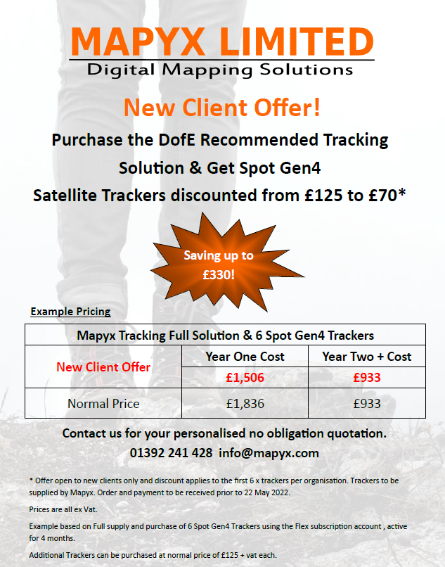
Our Current Introductory Offer
 |
What is tracking?
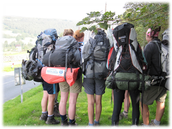
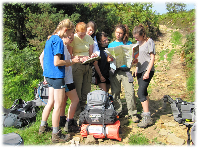
Trackers are fixed to a participant’s rucksack and Tracking systems display the locations of the trackers on receiving devices such as computers, mobile phones, and web portal. Therefore, trackers can be used to monitor the location and progress of groups on expeditions.
There are many ways satellite trackers can be used to meet duty of care requirements – ranging from SOS response to automatic tracking of a full journey.
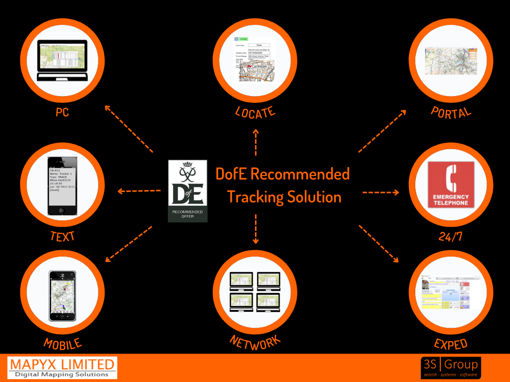
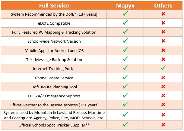
The Mapyx Tracking Solution is the most comprehensive tracking solution available and the only DofE Recommended solution. Tracking is available on PC, mobile (Android and iOS) and Web.
Back-up solutions on SMS Text.
To view a simple video.
Mapyx Quo v2 and Tracking - YouTube
Why Mapyx?
We are the best at what we do. Giving Leaders, teachers, participants, and parents peace of mind, enhancing the experience, safety, education, and protection of anyone taking part in all forms of outdoor activity.
*Tracking systems - The Duke of Edinburgh's Award (DofE) Shopping
** SPOT For Schools | Saved by SPOT | GB (findmespot.com)
Why schools come to us:

1.  We are the ONLY
Company Recommended by The Duke of Edinburgh's Award for Tracking, for over 13
years.
We are the ONLY
Company Recommended by The Duke of Edinburgh's Award for Tracking, for over 13
years.
2. We are the ONLY Company who provide a fully integrated system, with full OS mapping, full support, multiple back-up solutions and full accreditation – ‘not just an internet portal’ as described by one client.
3. Our staff are actively involved in education, DofE and rescue services, so understand the fundamental requirements of a comprehensive and usable tracking system. We do not just design software; we use it and train people how to use it.
4. If you need emergency assistance you can get it 24 hours a day, 365 days a year.
5. We use Ordnance Survey Mapping and NOT Google Maps, which are virtually useless in the outdoor environment.
6. Mapyx has unique accreditation:
a. Supplier to the Maritime Coastguard Agency.
b. Mountain Rescue England & Wales Official GIS & Digital Mapping Partner.
c. British Cave Rescue Council Official GIS & Digital Mapping Partner.
d. Search & Rescue Dog Association Exclusive Official Mapping Partner.
e. Lowland Search & Rescue Exclusive Official Mapping Partner.
f. Ordnance Survey, Ordnance Survey Ireland, Ordnance Survey Northern Ireland & Land & Property Services Official Partner.
g. Official MOD Contractor and Supplier.
h. Supplier to hundreds of Schools, Councils, Cadet Forces.
We strongly recommend Spot Trackers for DofE; however, we supply all types of tracking devices and solutions. Depending on your requirements, we can advise the best solution for your expedition needs.
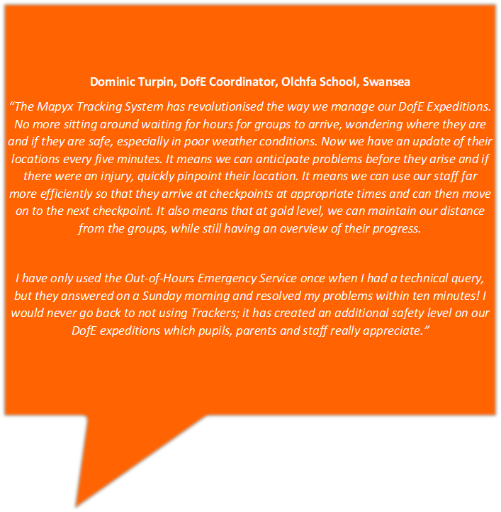
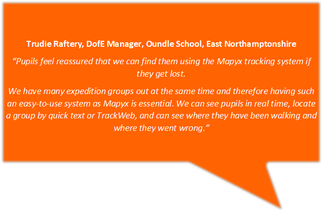
Testimonials
 |
|||
 |
|||
Contact us for your free personalised no obligation quotation


For further System Information please click the link below.
Tracking for Education - 3S Group Ltd.